LaThuile logo

BIKE WORLD

La Thuile MTB trail map

Here you can find maps of all the MTB, gravity and cyclist's trails

La Thuile Cycling MTB trails: technical info


Terrain: smooth and linear, with grazing meadows and juniper shrubs
Gradient: gradual
Ideal for: beginners and intermediate cyclists
Experience: perfect for enjoying the scenery and leisurely cycling

Download PDF map

Links and further information

La Thuile Gravity MTB trails: technical info

Terrain: steep and winding, with roots, stones and counterslopes

Gradient: steep, with challenging sections

Ideal for: experienced cyclists with strong technical skills and bike control

Experience: adrenaline-pumping, fun for expert cyclists

Download PDF map

Links and further information

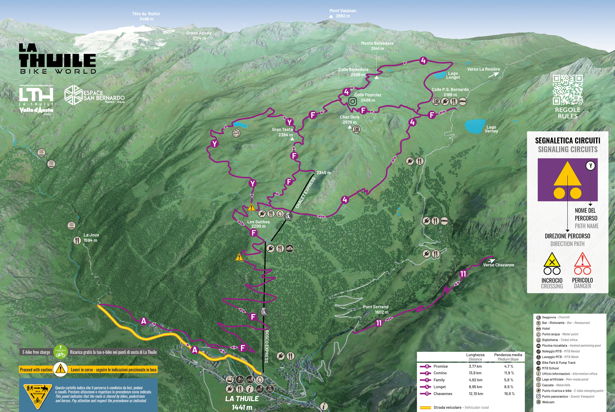
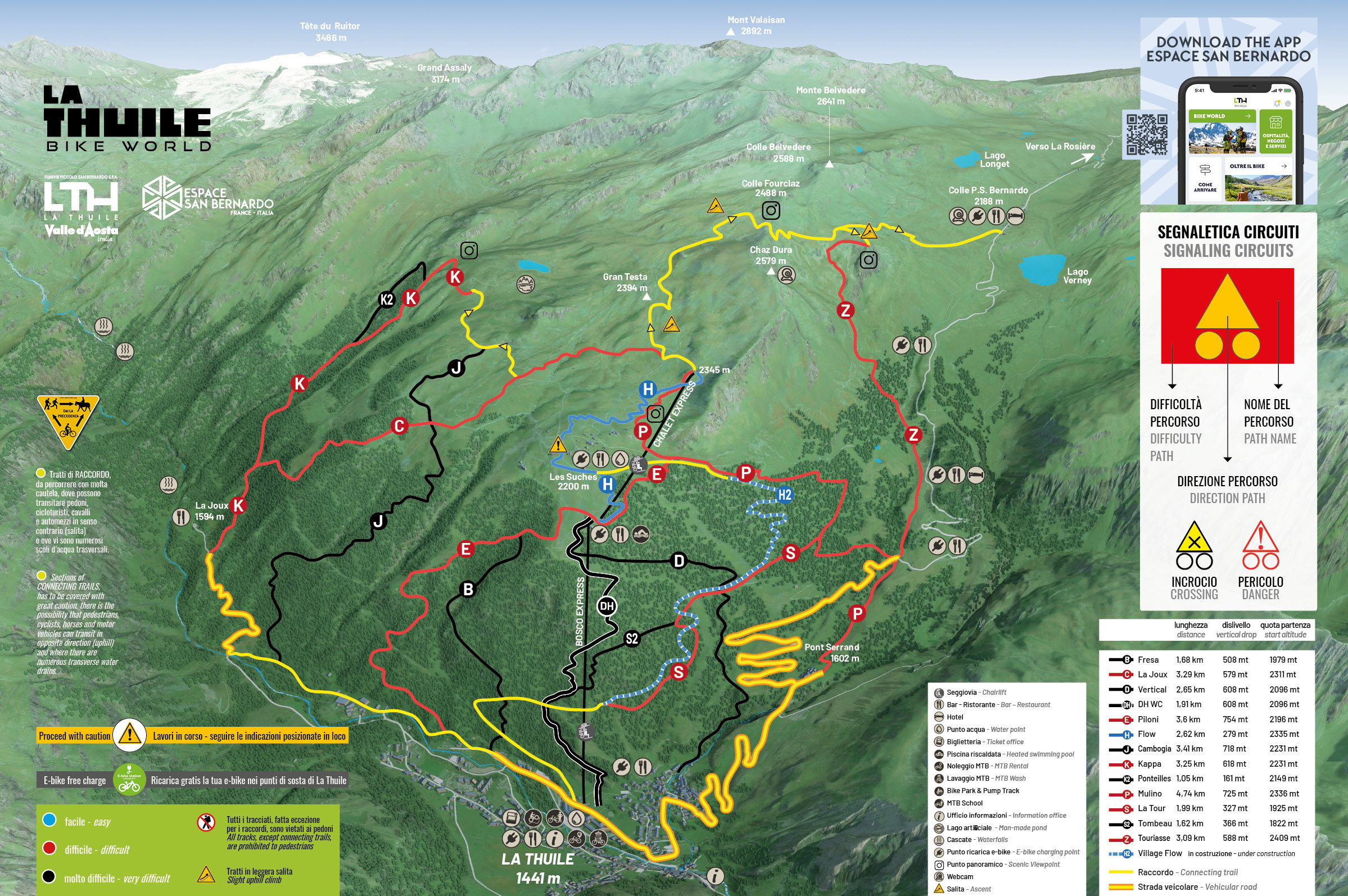
MTB Frontalier trail

A cycle-touring trail spanning Italy and France, created as part of the Alcotra  “4 Nouvelles liaisons” project , which you can tackle either end-to-end, or using chairlifts on either side. Using the chairlifts cuts down the elevation gain, making the trail accessible to all.


La Thuile – La Rosière
  • End-to-end cycling trail

    elevation gain of 1,454 m
    length 24.36 Km    

  • Trail using the lifts:

    elevation gain of 619 m 
    length 16.86 Km  

La Rosière – La Thuile
  • End-to-end cycling trail

    elevation gain of 999 m 
    length 20.27 Km  

  • Trail using the lifts:

    elevation gain of 570 m  
    length 15.42 Km  

Links and further information

Navigate our bikepark with the 3D map


Subscribe to our newsletter